The goal of the Utah Frontier Observatory for Research in Geothermal Energy (FORGE) project is to enable cutting-edge research and drilling and technology testing, as well as to allow scientists to identify a replicable, commercial pathway to enhanced geothermal systems (EGS). In addition to the site itself, the Utah FORGE effort will include a robust instrumentation, data collection, and data dissemination component to capture and share data and activities occurring at Utah FORGE in real time. The innovative research, coupled with an equally innovative collaboration and management platform, is truly a first of its kind endeavor.
Click to draw a polygon over the area to take a screenshot.
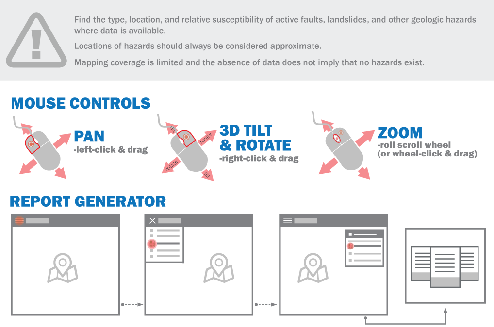
Although this product represents the work of professional scientists, the Utah Department of Natural Resources, Utah Geological Survey, makes no warranty, expressed or implied, regarding its suitability for a particular use. The Utah Department of Natural Resources, Utah Geological Survey, shall not be liable under any circumstances for any direct, indirect, special, incidental, or consequential damages with respect to claims by users of this product. The Utah Geological Survey does not guarantee accuracy or completeness of the data. The Utah Geologic Hazards Database contains geologic hazard information and data from the Utah Geological Survey (UGS) and other sources for the area of interest shown on the map below and can be used to identify mapped geologic hazards in an area, understand what the hazards are, and some potential ways to mitigate them. The database is periodically updated to incorporate the results of new mapping and/or updated mapping due to updated data and/or methodology; however, more-detailed fault traces and paleoseismic information may be available in recently published geologic maps and reports, so the database should not be considered exhaustive. Locations of mapped geologic hazards should always be considered approximate. The locational accuracy of hazards on the maps vary, and spatial error can be substantial when viewing structures at high zoom levels that were originally mapped at small scales. Therefore, the locations of hazards on the map should be considered approximate. Depending on the ultimate needs of the user, a site-specific investigation by a qualified Utah-licensed Professional Geologist may be required to accurately characterize the hazards at a particular site.
In 2008, the Utah Geological Survey Geologic Hazards Mapping Initiative was created with funding from the Utah Legislature to map geologic hazards in areas of existing and future development. This mapping is focused on identifying hazards for an entire 7.5′ quadrangle at 1:24,000 scale, instead of single hazard maps of large regional areas. The geologic-hazard maps address hazards associated with earthquakes, landslides, flooding, debris flows, indoor radon, shallow groundwater, rockfall, and problem soils and rocks. The initiative will provide planners, local officials, property owners, developers, engineers, geologists, design professionals, and the interested public with information on the type and location of critical geologic hazards that may impact existing and future development.
Hazard mapping is a multidisciplinary cooperative collaboration. We thank Scott Davis, Nathan Kota, Steve Gourley, and Jake Adam with the Utah Automated Geographic Reference Center (AGRC) for assistance and programming in the creation of the online web mapping application. Steve Bowman and Jessica Castleton (UGS) helped develop the schema and reporting format used in the current database. Marshall Robinson, Jay Hill, and Martha Jensen (UGS) and Corey Unger (former UGS) did web design and programming for the interactive map. UGS GIS analysts Gordon Douglass contributed substantially at various stages of development of the database. We thank the hazard mappers in the UGS hazard department for providing high quality hazard maps.
FORGE Geoscientific Webmap Data (Download)
Data download contains all GIS layers used to construct the webmap as a zipped .gdb file.
For questions concerning this download or the individual data layers please contact Stefan Kirby